COUNTY MAP GUIDE
Isle of Wight county maps
Newport, Ryde and Cowes provide useful reference points across the island. The coastline gives the county map a clear outline; wards, parishes and postcode sectors reveal very different patterns within it.
Get a bespoke map quote →Tell us what you need. Reply within an hour. Reading the island map
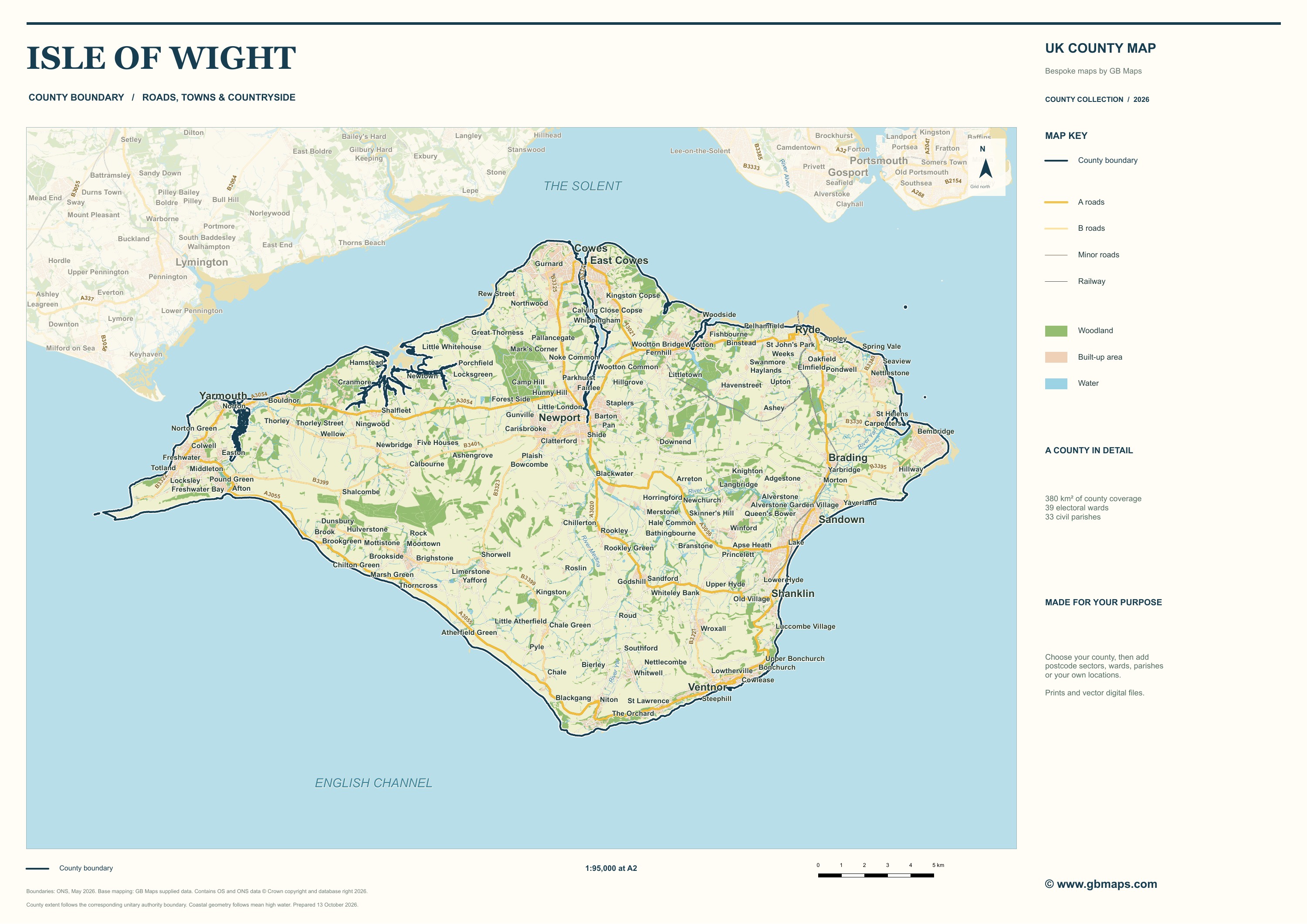
The Solent separates the Isle of Wight from the mainland. On the sample, start with Newport towards the centre of the island, then follow the northern coast through Cowes and East Cowes to Ryde. Sandown and Shanklin help orient the eastern coast, while the western peninsula and the island’s long southern coast give the map its distinctive shape. Roads, settlements, woodland and water supply context beneath the boundary overlays.
Population and the places it describes
The 2021 Census recorded 140,459 residents in the Isle of Wight local authority area. ONS reports 25,405 people in the Newport built-up area, 24,105 in Ryde, 14,365 in Cowes and 11,655 in Sandown. A built-up area is a statistical geography: it should not be treated as interchangeable with a civil parish or electoral ward. That distinction matters when population figures are placed on a map.
Choosing an island boundary map
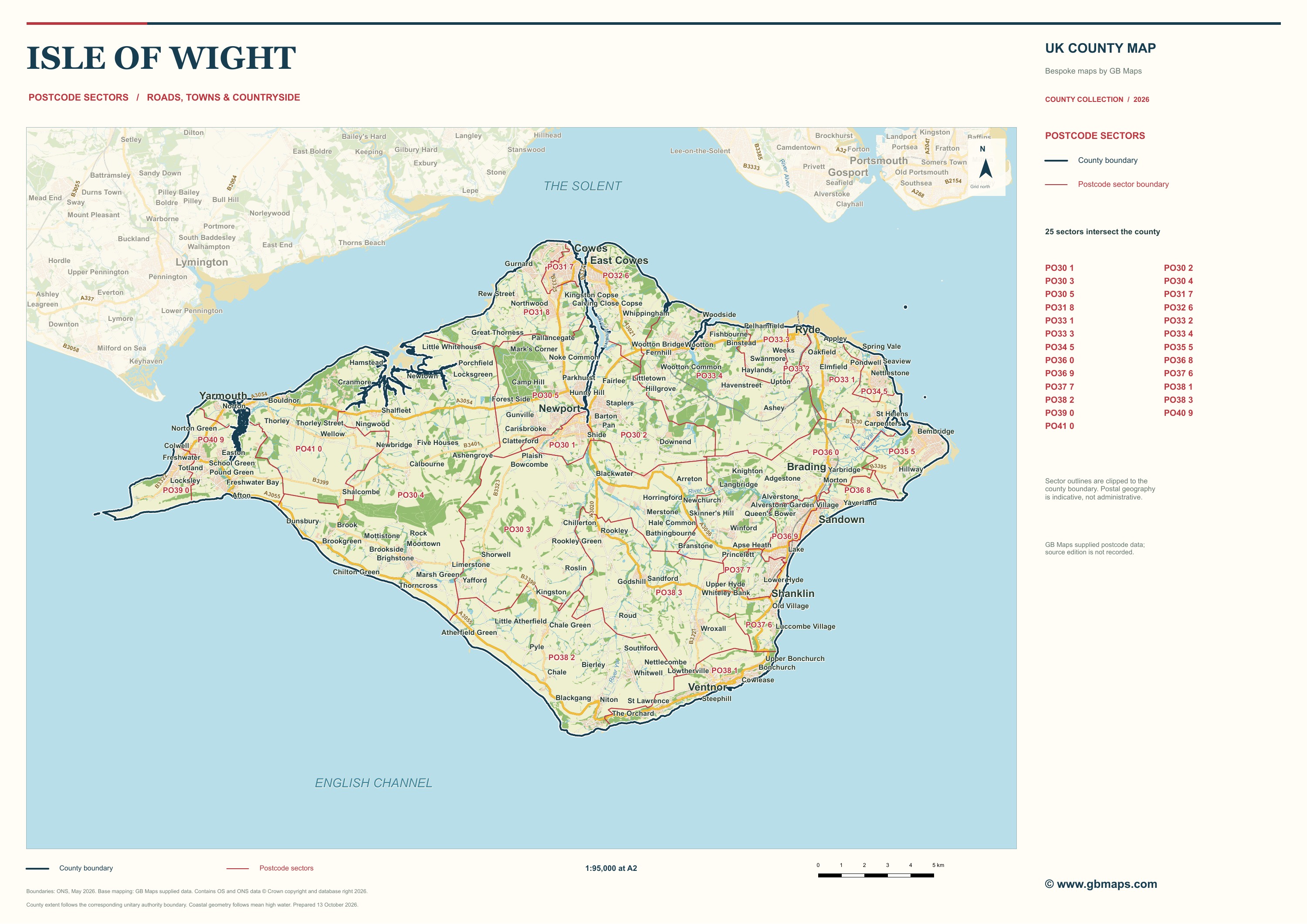
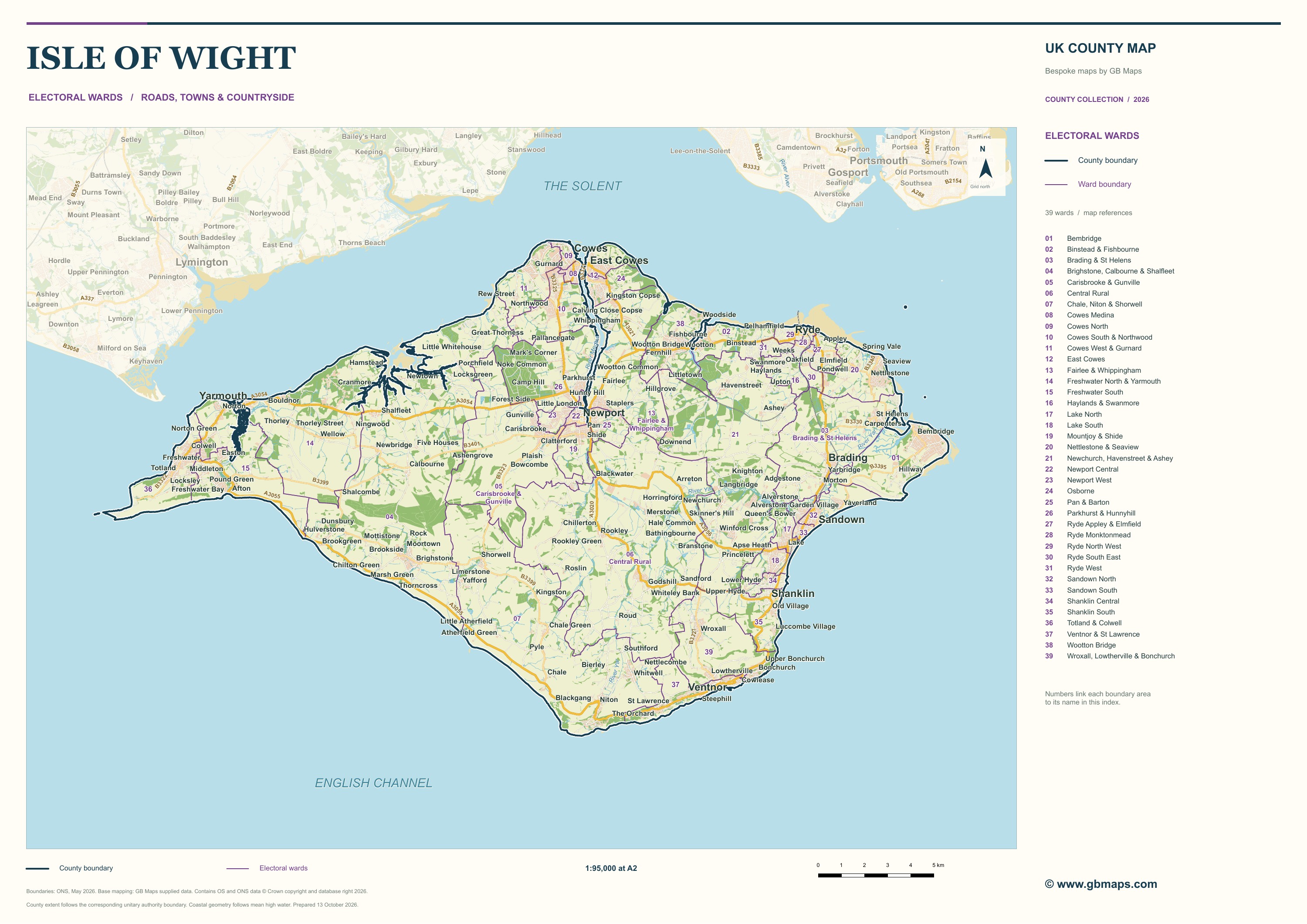
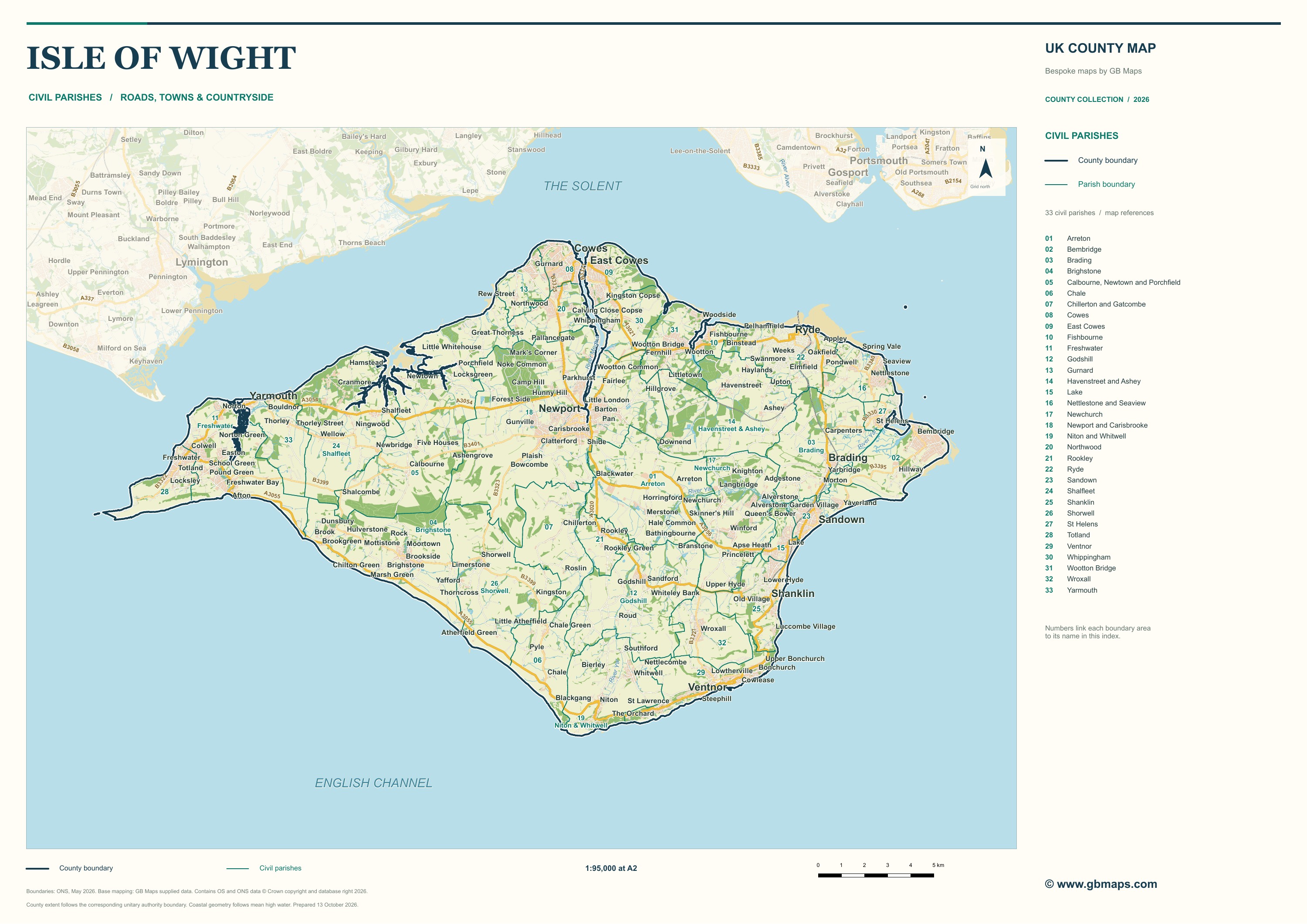
Use the county edition to present the island as a whole. The ward edition divides it into electoral areas; the parish edition shows a different set of local boundaries. The postcode-sector edition follows postal geography and is useful for discussing coverage. The samples let you compare how these layers sit over the same roads and settlements, rather than comparing unrelated base maps.
Adding your own information
For an island-wide service map, facilities and service areas can be shown alongside the main settlements. A community or consultation map may need parish names and an index. A visitor publication may need a simpler road hierarchy, selected attractions and a larger legend. Describe the audience and the intended page or wall size, and we can select the detail accordingly.
Which map edition fits your project?
- County
- A geographic overview: the county outline with roads, settlements and landscape context.
- Postcode sectors
- Postal geography for discussing coverage and territory data. These samples are indicative.
- Electoral wards
- Electoral areas shown over the same roads and places, with an index for the boundary names.
- Civil parishes
- A different local boundary system, useful for relating communities to the surrounding geography.
Explore ward and parish map design, postcode-sector mapping and county road maps, or compare all eight downloadable examples.