COUNTY MAP GUIDE
Rutland county maps
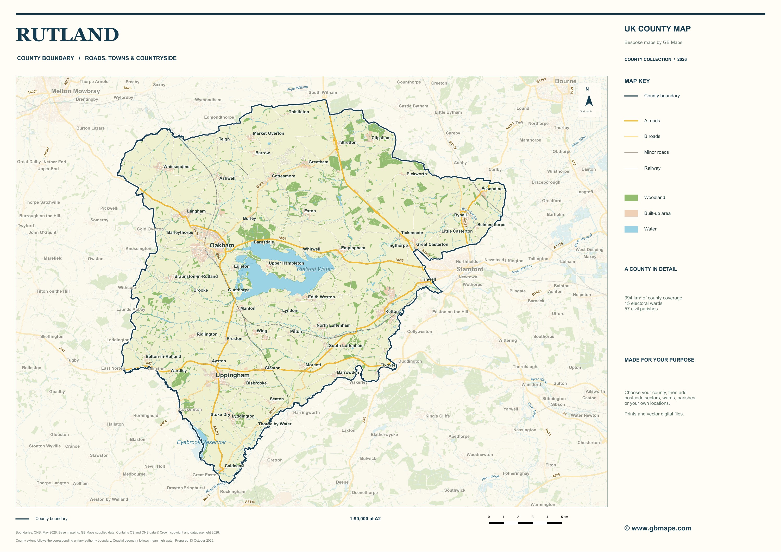
Oakham and Uppingham are Rutland’s two market towns. Rutland Water is a major feature of the county, while the A1 and A47 place its rural communities within the wider road network.
Get a bespoke map quote →Tell us what you need. Reply within an hour. Reading the Rutland map
Rutland County Council describes a rural county centred on the market towns of Oakham and Uppingham, with villages spread across the surrounding countryside. Rutland Water is an immediately recognisable feature on the county map. Follow the roads out from the two towns and the relationship between settlements, the reservoir and the county boundary becomes much easier to see.
Roads and the surrounding region
The A1 provides a north–south route through the county and the A47 an east–west connection. On a working map, keeping those main routes visually distinct from local roads helps explain access and movement without overwhelming smaller settlement names. A map for a local organisation can extend beyond the county boundary where nearby places or routes are relevant.
Parishes, wards and planning
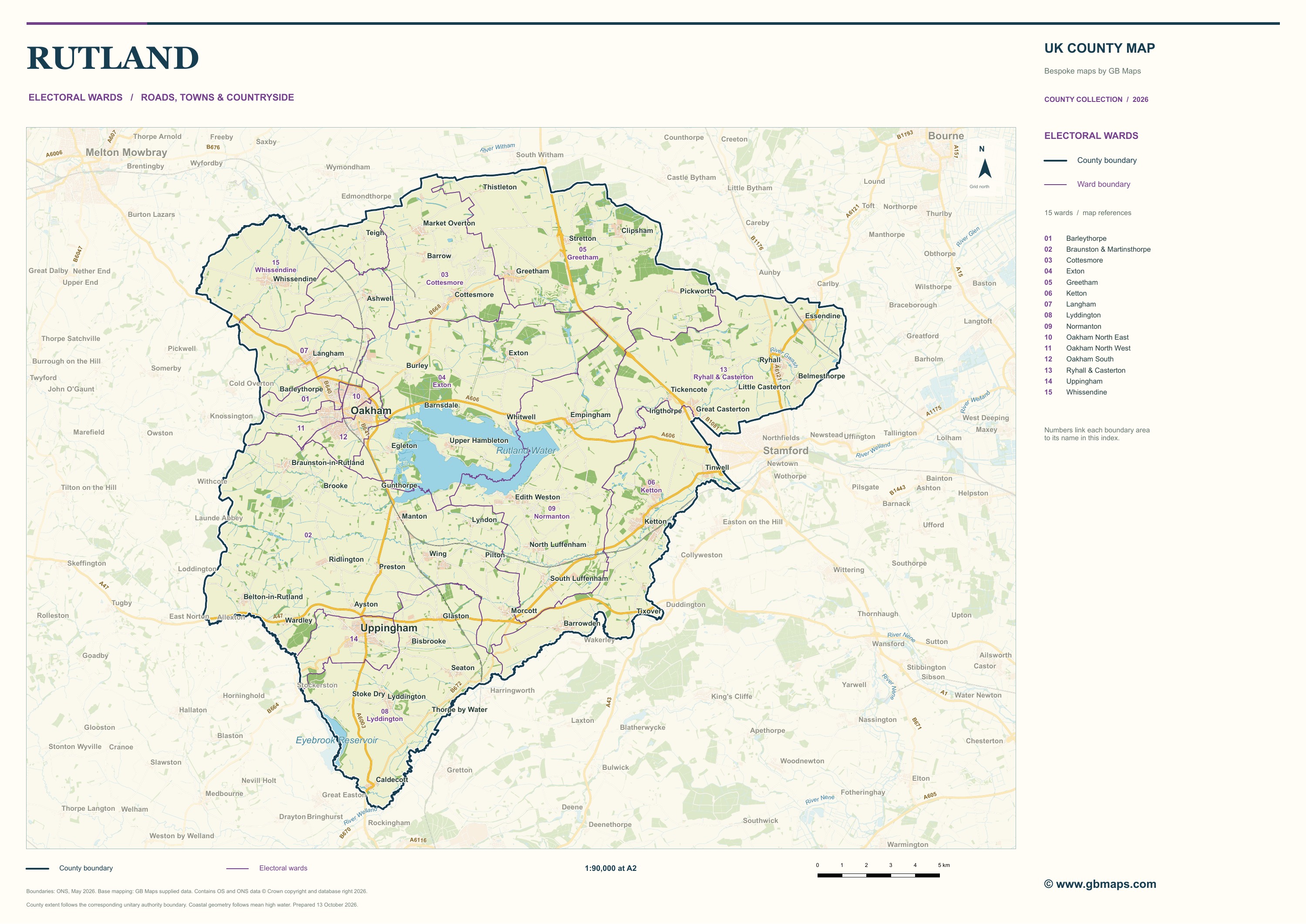
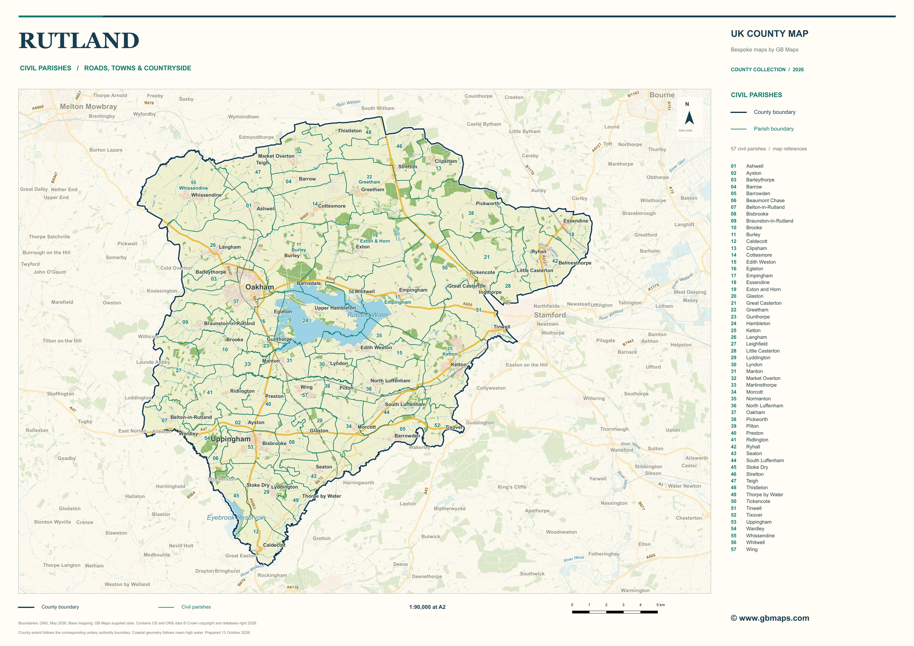
A county outline answers a different question from a parish or electoral ward map. The parish sample shows the local areas in relation to villages and roads; the ward sample shows electoral areas. A parish boundary alone does not establish every planning designation: any planning layer required for a commission needs its own agreed source and date.
Maps for local work and publication
The county edition suits a geographic overview. Parish and ward editions are useful starting points for community information, local research and consultation material. For a business map, we can add premises, coverage areas or values associated with geographic areas. The map, key and labels are designed together for the final print size, whether that is a report page or a large wall sheet.
Which map edition fits your project?
- County
- A geographic overview: the county outline with roads, settlements and landscape context.
- Postcode sectors
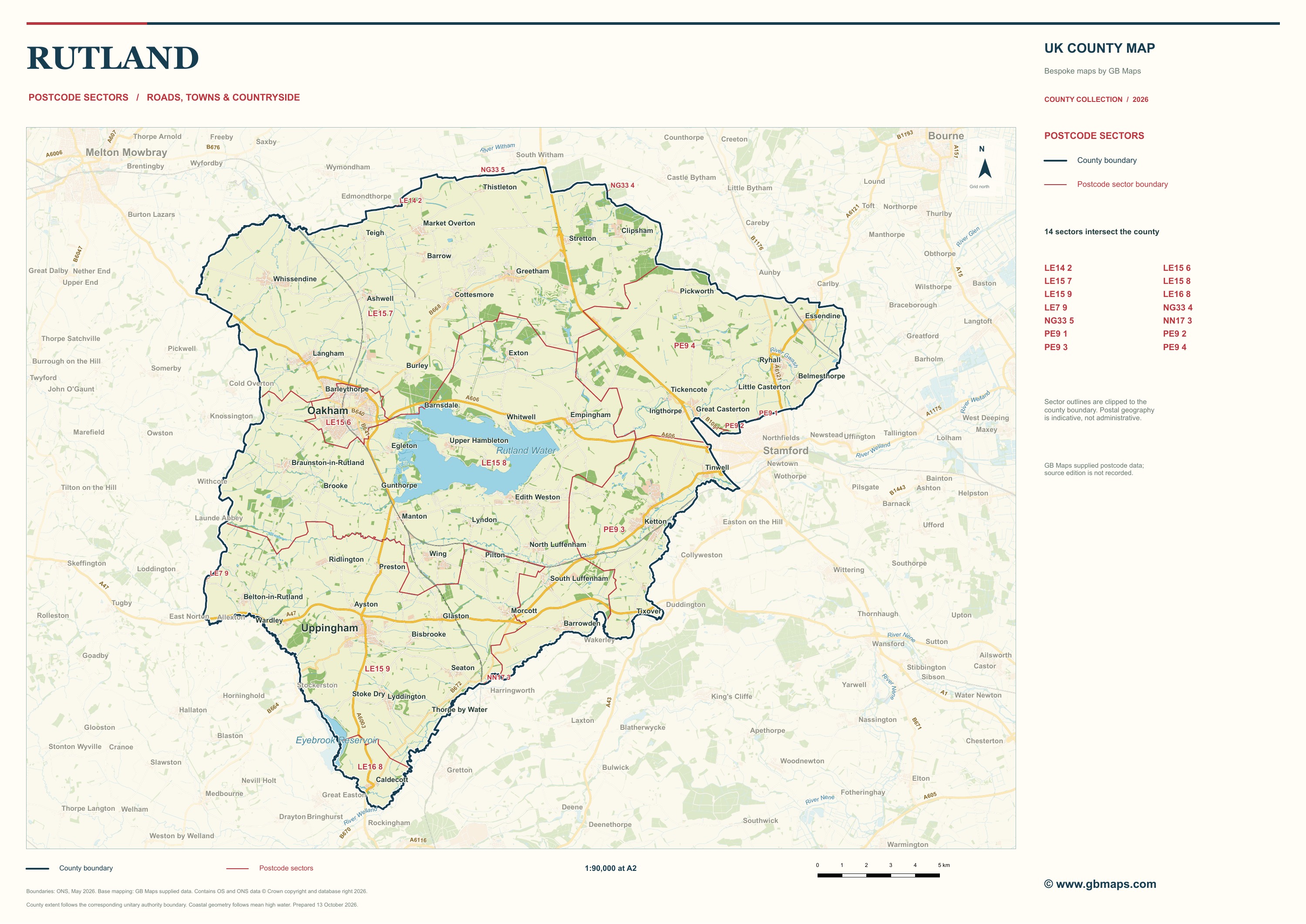
- Postal geography for discussing coverage and territory data. These samples are indicative.
- Electoral wards
- Electoral areas shown over the same roads and places, with an index for the boundary names.
- Civil parishes
- A different local boundary system, useful for relating communities to the surrounding geography.
Explore ward and parish map design, postcode-sector mapping and county road maps, or compare all eight downloadable examples.